

Enabling landers to autonomously identify the safest sites to touch down
Moon craters and their surrounding areas are high-value destinations for lunar missions since they may contain important resources and valuable science targets. However, these sites are also home to dangers such as steep slopes that are difficult to see in the challenging lighting conditions. As a result, selecting landing sites on lunar surfaces is a critical component for NASA’s CLPS (Commercial Lunar Payload Services) missions. A new technology tested through NASA’s Flight Opportunities program is set to go to the Moon and help provide a safe and precise landing.
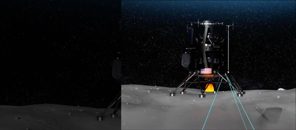
Astrobotic Technology’s Hazard Detection (HD) Lidar system scans and analyzes the terrain in real-time, enabling landers to autonomously map and select the safest landing sites. Lidar stands for light detection and ranging. The Pittsburgh-headquartered company will use its HD Lidar system when its Griffin lunar lander delivers science and technology payloads to the Moon during its CLPS delivery to the lunar south pole.
With Flight Opportunities support, Astrobotic first tested an engineering model of its advanced HD Lidar sensor in November 2024, confirming its ability to select a safe landing site by detecting and avoiding slopes, rough areas, and potential hazards. This flight test provided the Astrobotic team valuable data on the system’s performance, which was later leveraged by a second flight test in March 2026 with an integrated hazard detection and guidance, navigation, and control (GNC) system to further validate the system ahead of its first lunar mission scheduled for later this year. These flight tests helped the company advance the technology for use on its CLPS mission.
Preparing for Griffin Mission One | Flight testing lidar hazard detection video | Additional information
Preparing for Griffin Mission One
The Astrobotic Griffin Mission One will launch aboard a SpaceX Falcon Heavy rocket from Launch Complex 39A at NASA’s Kennedy Space Center in Florida to deliver NASA payloads to the lunar south pole.
Astrobotic’s HD Lidar system is designed to detect hazards as small as 5.9 inches (15 cm) and slopes greater than 10° to identify potential hazards, such as craters or large rocks. During the lander’s final descent phase, the spacecraft performs a stationary hover at an altitude of 100 meters — about the height of a 30-story building — while pointing its lidar toward the intended landing site. During the hover, the lidar scans the terrain, applies motion correction to account for changes in the spacecraft’s position and attitude, and processes the results into a hazard map used to identify the safest available landing location. The spacecraft then maneuvers to the selected landing site and proceeds with touchdown.
Astrobotic’s HD Lidar system works in tandem with its terrain relative navigation (TRN) sensor system, which takes live photos of the surface and compares them to an onboard map derived from orbital images to determine the spacecraft’s location above the lunar surface. In preparation for the CLPS mission, Astrobotic fully integrated its HD Lidar and TRN camera into its Griffin lander and demonstrated a successful soft landing simulation using Astrobotic’s Griffin Mission One production flatsat — a platform built with engineering models of the actual flight avionics.
Learn more about the Griffin Mission One CLPS delivery about Preparing for Griffin Mission One
Advancing Hazard Detection Lidar Through Flight Testing
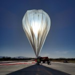
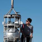
NASA’s Flight Opportunities program supported testing of Astrobotic’s HD Lidar as part of its mission to demonstrate promising technologies for space exploration, scientific discovery, and the expansion of space commerce. During the flight test on Nov. 11, 2024, an engineering model of the HD Lidar sensor successfully collected data over Astrobotic’s Lunar Surface Proving Ground while mounted on the company’s Xodiac reusable vertical takeoff vertical landing rocket. During the flight, the HD Lidar system processed the 3D lidar point cloud data into a terrain hazard map and helped verify lidar communications, settings, and controls under relevant conditions.
This flight test enabled Astrobotic to make a significant advancement in demonstrating space exploration technology capabilities, and the company applied lessons from this test directly to its lunar lander missions.

CLPS Flight: Astrobotic Griffin-1
Moon Missions for Flight-Tested Doppler Lidar
Commercial Lunar Payload Services Blog
NASA Tests New Ways to Stick the Landing in Challenging Terrain

Learn More About Flight Opportunities

More Technology Transitions
Learn about other technologies that have advanced their readiness through testing with Flight Opportunities.
Access Flight Testing
Learn more about how to flight test your technology, instrument, or experiment with the Flight Opportunities program.
Flight Providers
Learn about the commercial flight providers that engage with the Flight Opportunities program.
Keep Exploring


