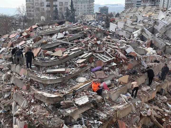
Earthquake Prediction: The Turkiye-Syria Earthquake in West Asian countries Turkey and Syria has caused great devastation. So far there have been more than 24 thousand deaths, while more than 40 thousand people have been injured. Apart from these, many people are feared to be buried under the debris of the buildings that were destroyed by the earthquake. After this devastation, many geologists said that they had warned of a devastating earthquake in Turkey. However, the earthquake was so deadly that it was impossible to save millions of people in such a short time.
The intensity of the earthquake in Turkey and Syria was 7.8, so far very few such earthquakes have occurred in West Asia. Although there are movements on the earth hundreds of times daily, but the effect of those earthquakes is very less. That is, there are hundreds of earthquakes every day, but are they not strong enough that we can notice them? Can some earthquakes, which cause heavy damage and loss of life, not be predicted?
Terrible incidents like the earthquake in Turkey raise many questions, let’s try to find answers to them.
Whose ‘fault’ is it when an earthquake occurs?
According to geologists, the Earth’s surface is made up of many kilometers of hard rock that is attributed to moving pieces called tectonic plates, which lie on a sea of hot, liquid rock and, as it cools, roll over, surrounding lighter plates. pushes. It is said that this collision of plates is an earthquake. Many earthquakes and volcanoes occur at the surface where plates meet. Due to the process inside the earth, there is pressure on the plates, and when suddenly the pressure is removed and the plate moves, the energy explodes in the surrounding rock.
How do you know how strong the earthquake was?
Scientists use seismographs to detect earthquakes, they have needles that record ground shaking, but many instruments are now completely digital. They have a global network, as well as local and regional networks, and much of the data is open-source and automatically connected. By combining at least 3 measurements, the system can accurately map the location, duration, and size of an earthquake.
In addition to seismometers, geologists and seismologists have a variety of instruments to collect data about the movements of the Earth’s crust. GPS-linked sensors are placed near seismically active sites to measure movement on the surface. Satellite images taken before and after an event can be compared pixel-by-pixel. A satellite-based radar called InSAR is one of the most important tools for studying how the Earth’s surface changes.
InSAR technology is very useful
InSAR reflects a beam of radio waves from orbit onto Earth, and a process of interferometry records changes in surface height to the precise millimetre. The satellite passes twice to see what has changed on the ground. Such techniques are now being tried on large datasets as well so that they can get earthquake signals faster.
Can an earthquake cause another earthquake?
Although some earthquakes are known to trigger other earthquakes, how this happens is a matter of great discussion among scientists. Earthquakes typically highlight two contradictions in how humans perceive the natural world, they occur over longer timescales than humans experience and at depths far greater than people are able to observe directly. Scientists manage this by building models and calculating probabilities.
After an earthquake, scientists look at the data to understand what might happen next. “We’ll have to put a stethoscope to Earth to determine what’s happening there,” said Harold Tobin, professor of earth science at the University of Washington.
How do we know an earthquake is coming?
Scientists are asked all the time whether it is possible to predict earthquakes. A scientist said about this, “We are not near a short-term forecast.” The United States Geological Survey, which documents global seismic events, is running a webpage to dispel prediction myths. The scientist said, ‘After a major earthquake, a huge amount of data is collected and decrypted, and some of it is immediately useful.’ He said, “We can calculate the places where there is more or less chance of earthquakes as a result.”